
Bataan Province
Brief Description
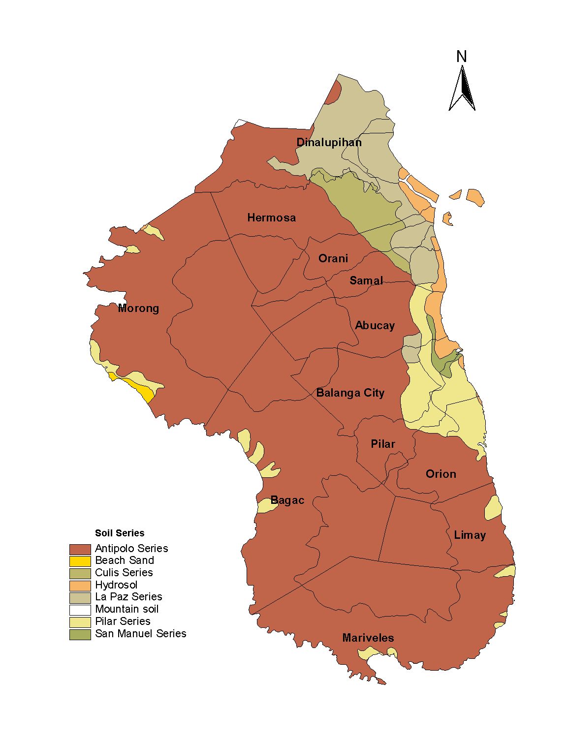
Being the smallest at the Southwestern part of Central Luzon the province of Bataan is a finger shaped peninsula that is bounded by the province of Zambales on the North Pampanga on the Northeast South China Sea on the West and Manila bay on the East The Battle of Bataan is famous in history as one of the last stands of American and Filipino soldiers before they were overwhelmed by the Japanese forces in World War II The Bataan Death March was named for this province where the infamous march started This is also the location of the Bataan Nuclear Power Plant located in the Municipality of Morong
| Geography | Bataan is the peninsula in the western part of Luzon that shields the Manila Bay on its south and east from the South China Sea on its west Zambales and Pampanga form its boundaries on the north |
| Region | Region III |
| Capital | Balanga City |
| Barangay | 237 |
| Component Cities | Balanga City |
| Municipalities | Abucay, Bagac, Dinalupihan, Hermosa, Limay, Mariveles, Morong, Orani, Orion, Pilar, Samal |
| Land Area | 1,372.98 |
| Population | 687,482 |
| Climate | Bataan has distinct dry and wet seasons categorized as Type I in the Coronas system The dry season begins in November and ends in April while the rainy season starts in May and ends in October The most rains come in June to August Mean average rainfall in August is heaviest at 633 mm Bataan is often visited by typhoons Farming systems in the province follow these climatic cycles Most crops including fruit trees and other perennials are planted during the rainy season so that the young plants receive as much rain water before the dry months |
| Coordinates | 1440N 12025E |
| All ecosystem (2015) | |||
|---|---|---|---|
| January - June (mt) | 86,197.00 | July - December (mt) | 65,413.00 |
| Irrigated (2015) | |||
| January - June (mt) | 86,197.00 | July - December (mt) | 63,365.00 |
| Lowland rainfed (2015) | |||
| January - June (mt) | 0.00 | July - December (mt) | 2,048.00 |
| Upland (2015) | |||
| January - June (mt) | 0.00 | July - December (mt) | 0.00 |