
Capiz Province
Brief Description
The Province of Capiz is known as the Seafood Capital of the Philippines
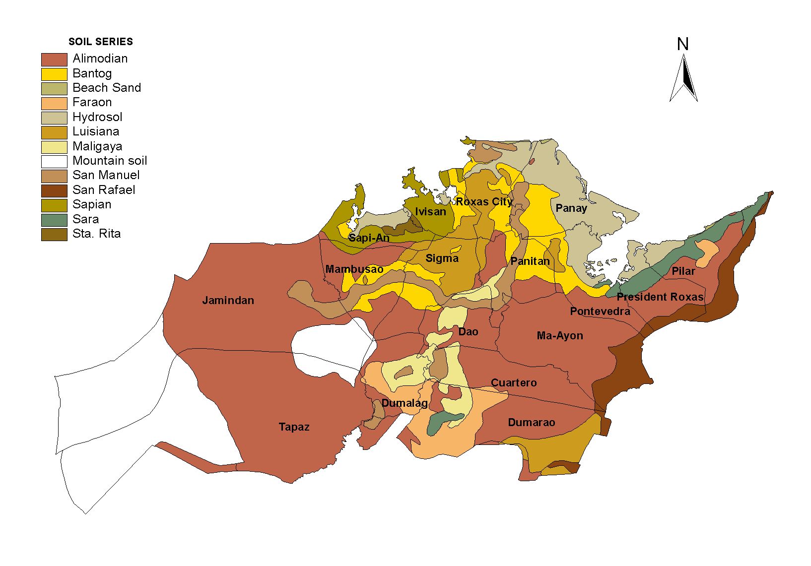
| Geography | Capiz is located on a small island formed by the Panay and Banica rivers The Panay river used to be famous for the great number of alligators thriving there The soil is poor in the northern part of the island and is most productive only in the southern part Capiz is bounded by the Mindoro sea the Panay Loctugan and Ibisan rivers |
| Region | Region VI |
| Capital | Roxas City |
| Barangay | 473 |
| Component Cities | Roxas City |
| Municipalities | Cuartero, Dao, Dumalag, Dumarao, Ivisan, Jamindan, Maayon, Mambusao, Panay, Panitan, Pilar, Pontevedra,President Roxas, Sapian, Sigma, Tapaz |
| Land Area | 2,594.64 |
| Population | 719,685 |
| Climate | The Philippine Atmospheric Geophysical an Astronomical Services Administration PAG ASA classifies all the towns of Capiz as Type 3 Climate Coronas Classification System Seasons are not very pronounced in Type 3 Climates However rainfall distribution is relatively dry from November to April and very wet during the rest of the year Driest month is April while the wettest month is June The dry northeast wind Amihan causes the dry season while the southeast monsoon Habagat brings the wet season due to its humid air that drops off rain during the rest of the year |
| Coordinates | 1123N 12238E |
| Upland (2015) | |||
|---|---|---|---|
| January - June (mt) | 0.00 | July - December (mt) | 1,200.00 |
| Lowland rainfed (2015) | |||
| January - June (mt) | 53,519.00 | July - December (mt) | 104,542.00 |
| Irrigated (2015) | |||
| January - June (mt) | 35,017.00 | July - December (mt) | 62,545.00 |
| All ecosystem (2015) | |||
| January - June (mt) | 88,536.00 | July - December (mt) | 168,287.00 |