
Iloilo Province
Brief Description
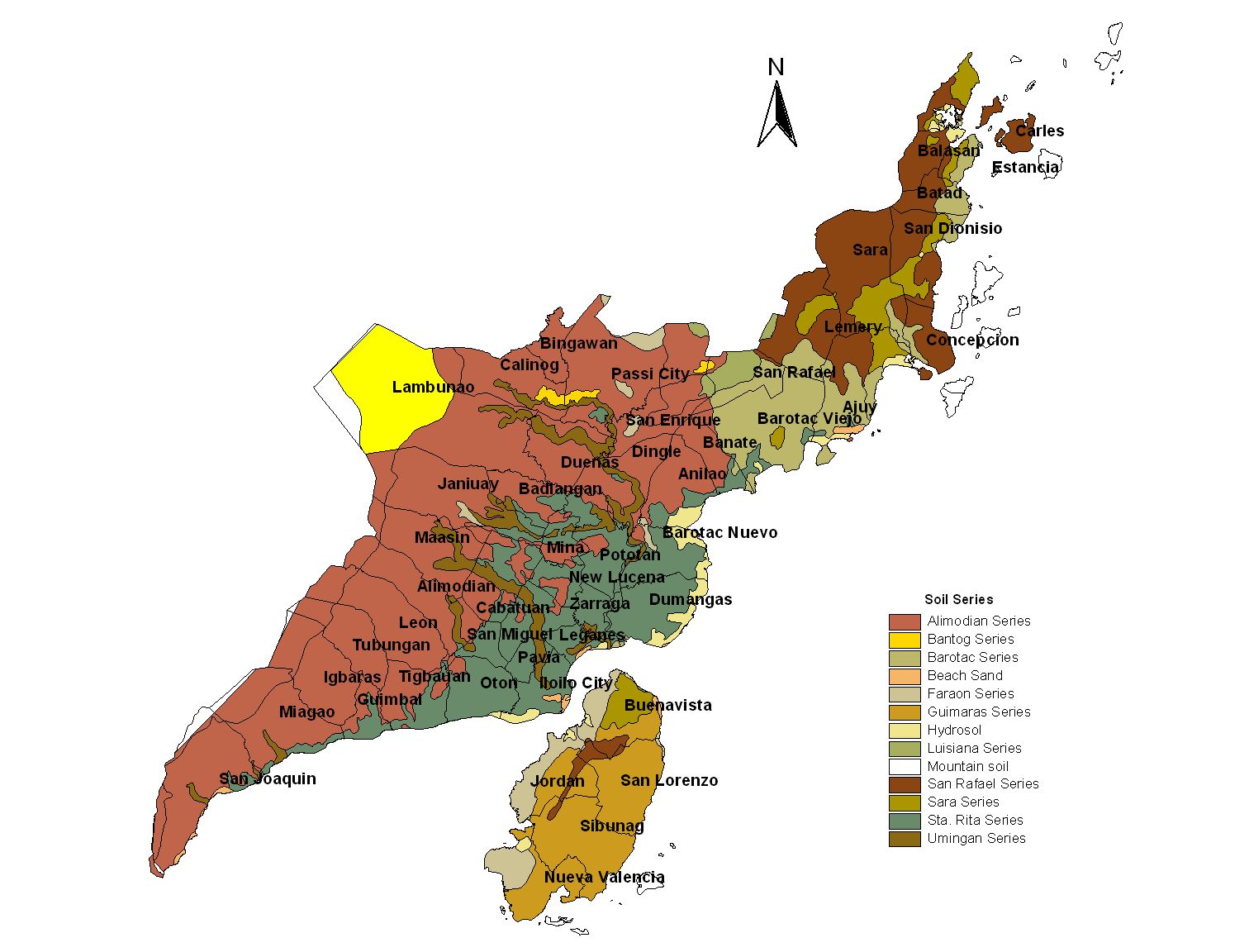
Iloilo is set in a graceful repose between Iloilo and Batiano rivers forming an angle of a nose Hence its old name Ilong Ilong which means noselike Mountain ranges with peaks as high as almost 7000 ft provide natural boundaries between Iloilo and Antique on the west and Capiz on the north The rest of mainland Iloilo is largely plain with interspersing upland portions
| Geography | Iloilo is located in the center of the Philippine archipelago Strategically located 283 statute miles from Manila it is the gateway to the flourishing region that is Western Visayas The province comprises the southeastern part of Panay Island |
| Region | Region VI |
| Capital | Iloilo City |
| Barangay | 1721 |
| Component Cities | Iloilo City, Passi City |
| Municipalities | Ajuy, Alimodian, Anilao, Badiangan, Balasan, Banate, Barotac Nuevo, Barotac Viejo, Batad, Bingawan, Cabatuan, Calinog, Carles, Concepcion, Dingle, Due |
| Land Area | 5,079.17 |
| Population | 1,805,576 |
| Climate | It is dry from December to June and wet from July to November along the southern northern part of the province and portion of the central municipalities Theres no distinct wet and dry season in the Iloilo Capiz border The annual rainfall is 159380 mm but the average annual rainfall for the past five years 1993 1997 is 235494 mm |
| Coordinates | 1100N 12240E |
| Upland (2015) | |||
|---|---|---|---|
| January - June (mt) | 0.00 | July - December (mt) | 905.00 |
| Lowland rainfed (2015) | |||
| January - June (mt) | 145,334.00 | July - December (mt) | 313,567.00 |
| Irrigated (2015) | |||
| January - June (mt) | 161,753.00 | July - December (mt) | 255,517.00 |
| All ecosystem (2015) | |||
| January - June (mt) | 307,087.00 | July - December (mt) | 569,989.00 |