
Isabela Province
Brief Description
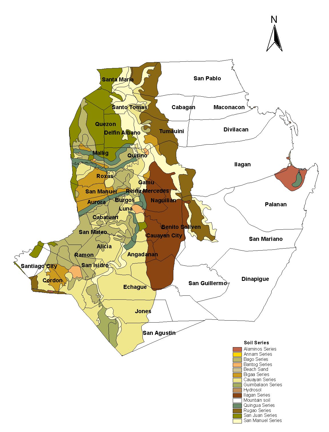
Home to the Yogads and Gaddangs the province is divided into three physiographic areas The eastern area straddled by the Sierra Madre Mountain Range is rugged and thickly forested Substantial portion is uncharted and unexplored hinterlands and home to a rich variety of flora and fauna while some are government reservations The western area is a sprawling fertile valley hemmed by the Central Cordillera and is criss crossed by the mighty Cagayan Siffu and Magat Rivers Its mountains rise to a peak of about 6000 feet and is home to one of the world
| Geography | Isabela is a province of the Philippines the second largest province in the country next to Palawan It is located in the Cagayan Valley region in the island of Luzon Its capital is Ilagan City and borders clockwise from the south Aurora Quirino Nueva Vizcaya Ifugao Mountain Province Kalinga and Cagayan This primarily agricultural province is the rice and corn granary of Luzon due to its plain and rolling terrain In 2012 the province was declared as countrys top producer of corn with 1209524 metric tons |
| Region | Region II |
| Capital | Ilagan City |
| Barangay | 1,018 |
| Component Cities | Cauayan City, Ilagan City, Santiago City |
| Municipalities | |
| Land Area | 12,414.93 |
| Population | 1,489,645 |
| Climate | Generally the province has two types of climate The eastern and coastal areas experience moderate rainfall more or less distributed throughout the year while Western Isabela has more pronounced wet and dry seasons The average temperature is recorded at 271 degrees Celsius |
| Coordinates | 1700N 12200E |
| All ecosystem (2015) | |||
|---|---|---|---|
| January - June (mt) | 668,315.00 | July - December (mt) | 588,075.00 |
| Irrigated (2015) | |||
| January - June (mt) | 631,884.00 | July - December (mt) | 568,718.00 |
| Lowland rainfed (2015) | |||
| January - June (mt) | 35,224.00 | July - December (mt) | 18,661.00 |
| Upland (2015) | |||
| January - June (mt) | 1,207.00 | July - December (mt) | 696.00 |