
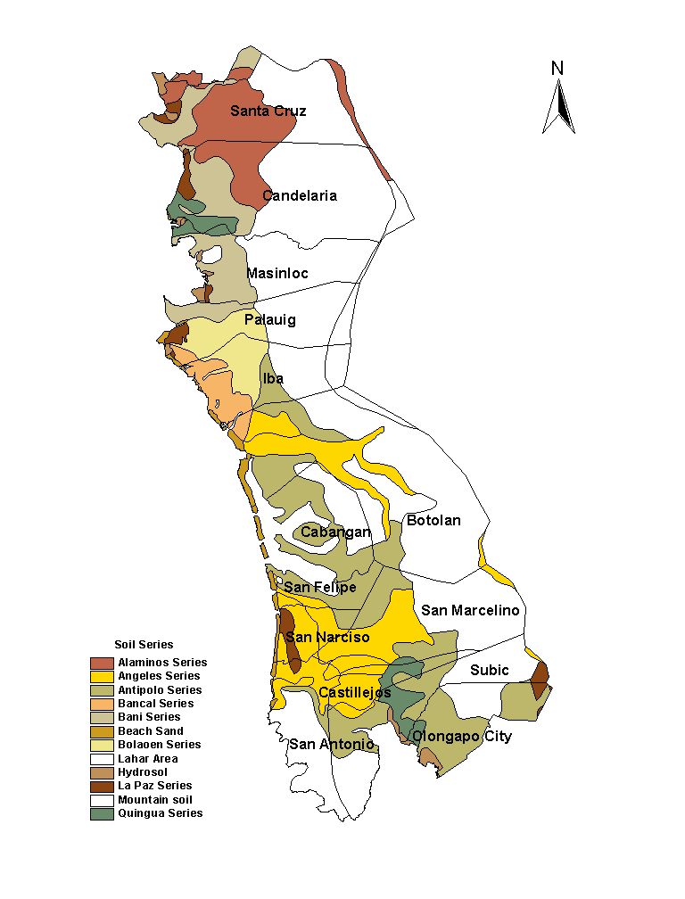
Zambales Province
Brief Description
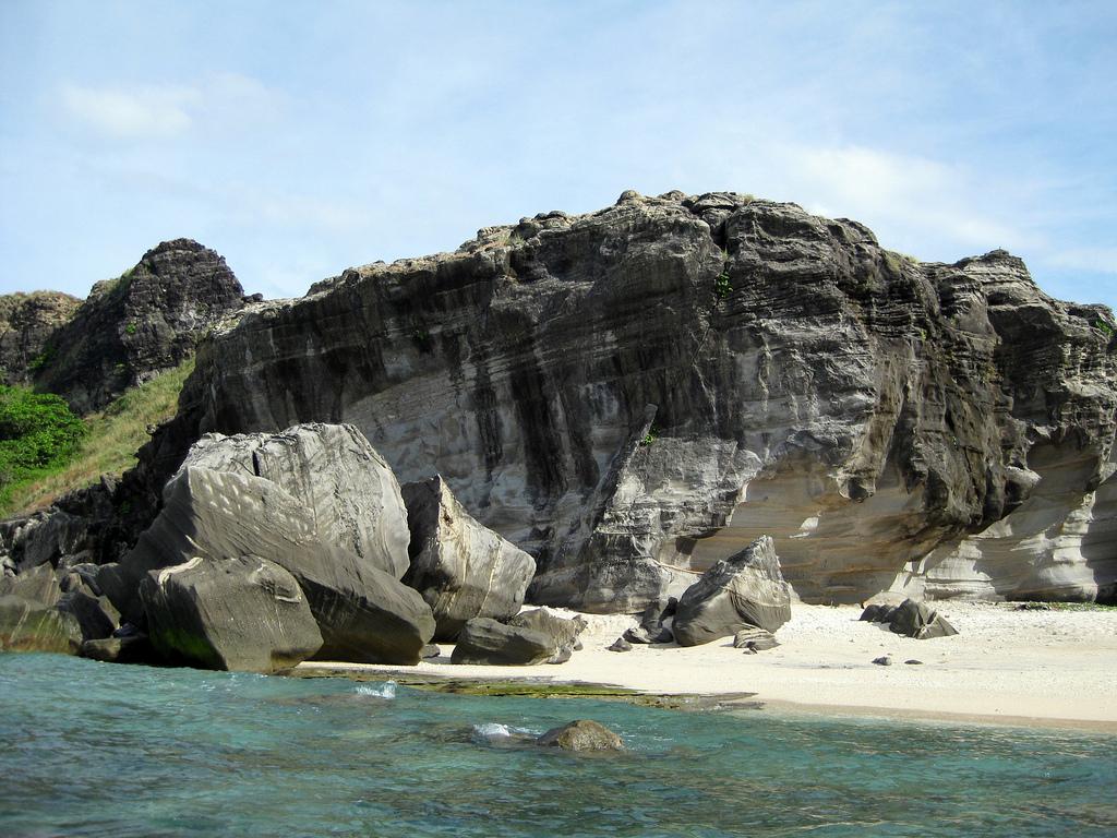
Zambales has been gifted with the natural beauty of its surroundings It has been touched by civilization yet has maintained its rustic glory and beauty The Zambales coastline is most famous for its sandy beaches and deep blue sea teeming with coral reefs The province is historical Located here is the ancestral house of the most beloved Philippine President Ramon Magsaysay situated at Castillejos Mt Pinatubo world famous for its 1991 catastrophic eruption can be found in the vicinity Zambales is perfectly suited for visitors seeking an authentic view of the Philippines without going too far from the national capital Manila It is located at the western part of Luzon 210 kilometers or approximately a three hour drive from Manila
| Geography | Zambales as the second largest province in Central Luzon shares common boundaries with Pangasinan on the North Tarlac and Pampanga on the East and Bataan on the South The entire stretch of the Province on the west is rimmed by the crystal clear water of vast China Sea |
| Region | Region III |
| Capital | Iba |
| Barangay | 247 |
| Component Cities | Olongapo City |
| Municipalities | Subic, Castillejos, San Marcelino, San Antonio, San Narciso, San Felipe, Cabangan, Botolan, Iba, Palauig, Masinloc, Candelaria, Santa Cruz |
| Land Area | 3,830.83 |
| Population | 534,443 |
| Climate | Zambales has two pronounced seasons dry from October to June and wet from July to September |
| Coordinates | 1520N 12010E |
| All ecosystem (2015) | |||
|---|---|---|---|
| January - June (mt) | 47,218.00 | July - December (mt) | 90,750.00 |
| Irrigated (2015) | |||
| January - June (mt) | 47,218.00 | July - December (mt) | 57,499.00 |
| Lowland rainfed (2015) | |||
| January - June (mt) | 0.00 | July - December (mt) | 33,113.00 |
| Upland (2015) | |||
| January - June (mt) | 0.00 | July - December (mt) | 138.00 |